
VR Module · Civil · Engineering
Total Station Survey - VR module.
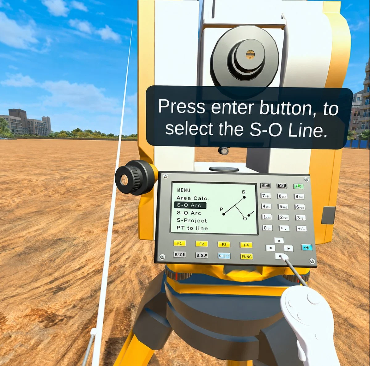
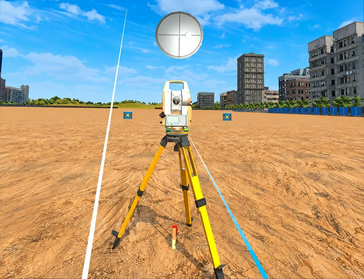
Set up a total station in a virtual survey field, take angle and distance readings to target points, and compute coordinates and levels - powered by a dynamic trigonometric engine, so your readings depend on your setup.
See it
Inside the module.
Learning objectives
By the end of this module, students will be able to:
Understand the working of a total station and its role in modern surveying
Set up the instrument with centring, levelling, focusing, and orientation
Measure horizontal angle, vertical angle, slope distance, and target readings
Calculate coordinates, reduced levels, height differences, and point positions using trigonometry
Perform backsight, foresight, point observation, and data recording
Recognise common survey errors - poor levelling, wrong target, incorrect backsight, and observation inaccuracy
About the module
Real survey workflows, in a virtual field.
A total station combines an electronic theodolite, electronic distance measurement, and on-board computation to measure angles, distances, elevations, and coordinates. It is central to construction layout, topographic survey, road alignment, building setting-out, and land measurement.
In this module, students work in a virtual survey field and operate the instrument step by step - setting it up, orienting it to a reference, sighting target points, and seeing how survey data is generated. A dynamic trigonometric calculation engine drives the results: values are computed from the learner's chosen points, instrument position, angles, and observation sequence, so different setups produce different readings.
That makes the link between field practice and theory concrete - horizontal and vertical angles, slope distances, height differences, and coordinates, alongside instrument and prism height, line of sight, backsight orientation, foresight observation, reduced levels, and coordinate transformation. It works well as a pre-lab activity, a virtual survey lab, or an assessment, easing pressure on limited physical instruments. The 7thi AI tutor and built-in assessment run throughout.
ABET (United States)
Supports Student Outcome 1 through engineering knowledge in surveying, coordinate geometry, and field measurement, and Student Outcome 6 through experimentation, data collection, and interpretation.
NBA (India)
Maps to Course Outcomes in Surveying, Advanced Surveying, and Geomatics, supporting POs around engineering knowledge, problem analysis, investigation, and modern tool usage (notably PO4 and PO5).
University syllabi
Maps to survey lab experiments, unit topics, course outcomes, field practice, and assessment rubrics. Request a custom mapping.
AICTE / NEP 2020
Aligns with Civil Engineering, Surveying, Geomatics, and Construction Engineering outcomes, supporting experiential, competency-based, and digital tool-enabled learning.
Get this module
Included in these iXRLabs packages.
Civil Engineering
CoreCivil VR modules - structures, construction, surveying, geotechnics, and materials.
Complete Engineering
All disciplinesThe full engineering library - 240+ modules across mechanical, civil, and electrical, including Total Station Survey.
Custom rollout
QuotePick specific modules, devices, and seat counts. We'll scope a deployment for your department.
7thi and assessment in this module
7thi in this module
Students can ask 7thi questions at any point - about survey setup and coordinate calculation or anything they see in the experiment. 7thi answers in context, without breaking the flow.
Assessment
Session data - concepts mastered, time per scene, assessment scores - appears on the faculty dashboard. Export to your LMS via xAPI.
Keep exploring
Related engineering modules.
What makes the readings dynamic?
A trigonometric calculation engine computes results from the learner's instrument position, selected points, angles, and observation sequence - so readings depend on the field setup, and different students get different values, just like real surveying.
What prior knowledge do students need?
Foundation-level surveying or coordinate geometry. Suitable for undergraduate Year 1 and above, and for diploma/polytechnic survey practice.
How long is a typical session?
About 45 minutes for a full run including assessment. Students can pause and resume, and faculty can assign specific procedures.
Does it cover instrument setup, not just measurement?
Yes - centring, levelling, focusing, and orientation are all part of the workflow, along with backsight, foresight, observation, and data recording.
Which headsets is this module optimised for?
HTC, Meta Quest 2 / 3 / Pro, ClassVR, and any WebXR-compatible browser. It also runs in desktop browsers without a headset.
See Total Station Survey in a demo.
Thirty minutes, the full module, your curriculum questions answered.